EN
DE


Welcome to the cutting-edge of uphill cycling
and world's most famous ascents of each of the continents
 #passzwang
Welcome to the cutting-edge of uphill cycling
and world's most famous ascents of each of the continents
| Home | |||
| Database | |||
 | World Map | ||
| World's highest cyclable roads | |||
| Overview | |||
| New in 2023 | |||
 | Štulac Sedlo | 1,957m | |
| | Durmitor Sedlo | 1,908m | |
 | Sveti Jure | 1,762m | |
 | Qafa Thores | 1,681m | |
 | Visočica Sedlo | 1,625m | |
 | Galičica Sattel | 1,564m | |
 | Prevalac | 1,560m | |
 | Modré Sedlo | 1,500m | |
| | Vrbatova Bouda | 1,400m | |
| | Qafa Bordolecit | 1,355m | |
| | Krstac | 958m | |
 | Suur Munamägi | 318m | |
 | Gaizinkalns | 312m | |
 | Aukštojas | 294m | |
 | Cap de Formentor | 225m | |
| New in 2022 | |||
 | Zillertal Höhenstr. | 2,015m | |
 | Mt. Olympos | 1,950m | |
 | Juvasshytta | 1,851m | |
 | Monte Zoncolan | 1,750m | |
 | Sliezsky Dom | 1,670m | |
| | Dalsnibba | 1,459m | |
 | Spindlerpass | 1,200m | |
 | Kekestetö | 1,014m | |
 | Flatruet | 975m | |
| | Trollstigen | 866m | |
| | Ørnevegen | 623m | |
| European Alps | |||
| | Theodulpass | 3,332m | |
 | Hohtälli | 3,286m | |
 | Col du Jandri | 3,150m | |
| | Hohsaas | 3,142m | |
| | Madritschjoch | 3,123m | |
| | Rothorn | 3,103m | |
| | Gornergrat | 3,089m | |
| | Gaislachkogel | 3,040m | |
| | Ortlerhaus | 3,025m | |
| | Wurmkogel | 3,023m | |
| | Colle Sommeiller | 3,009m | |
| | Festkogel | 2,898m | |
| | Eisjöchl | 2,895m | |
| | Stubai Glacier | 2,889m | |
| | Ötztal Glacier | 2,822m | |
| | Cime de la Bonette | 2,802m | |
| | Col de l'Iseran | 2,770m | |
| | Viderjoch | 2,763m | |
| | Stilfser Joch | 2,758m | |
| | Kaunertal Glacier | 2,750m | |
| | Colle dell'Agnello | 2,744m | |
| | Col du Chaberton | 2,674m | |
| | Gaviapass | 2,652m | |
| | Col du Galibier | 2,645m | |
| | Colle del Nivolet | 2,612m | |
| | Großglockner | 2,571m | |
| | Timmelsjoch | 2,509m | |
| | Umbrailpass | 2,503m | |
| | Nufenenpass | 2,478m | |
| | Great St. Bernard | 2,473m | |
| | Furkapass | 2,436m | |
| | Hochwurtenspeicher | 2,422m | |
| | Großsee | 2,414m | |
| | Oscheniksee | 2,394m | |
| | Col d'Izoard | 2,360m | |
| | Albulapass | 2,315m | |
| | Uina Gorge | 2,309m | |
| | Julierpass | 2,284m | |
| | Kronplatz | 2,275m | |
| | Sellajoch | 2,240m | |
| | Passo Pordoi | 2,239m | |
| | Passo Giau | 2,236m | |
| | Sustenpass | 2,224m | |
| | Little St. Bernard | 2,188m | |
| | Grimselpass | 2,164m | |
| Rocky Mountains | |||
 | Mount Evans | 4,307m | |
| Hawaii | |||
| | Mauna Kea | 4,200m | |
| Germany | |||
 | Osterfelderkopf | 2,032m | |
| | Nebelhorn | 1,932m | |
| | Alpe Schlappold | 1,740m | |
| | Eagle's Nest | 1,716m | |
| | Roßfeld-Höhenring | 1,540m | |
| | Riedbergpass | 1,420m | |
| | Feldberg | 1,493m | |
| | Fichtelberg | 1,215m | |
| | Brocken | 1,142m | |
| | Salwert | 11m | |
| Other Europe | |||
| | Sniezka | 1,602m | |
 | Klinovec | 1,244m | |
 | Botrange | 694m | |
 | Kneiff | 560m | |
 | Vaalserberg | 323m | |
 | Møllehøj | 171m | |
| Andes | |||
 | Uturuncu | 5,768m | |
| | Chacaltaya | 5,300m | |
| | Salar de Uyuni | 3,650m | |
| | Yungas Death Road | 3,200m | |
| Himalayas | |||
 | Khardung La | 5,602m | |
| | Taglang La | 5,358m | |
| | Potokonkga La | 4,900m | |
| | Namshang La | 4,800m | |
| | Lamayuru Monastery | 3,714m | |
| Ethiopian Highlands | |||
 | Tulluu Dimtuu | 4,377m | |
| Alborz-Range (Iran) | |||
 | Dizinpass | 3,257m | |
| | Emamzadeh Davod | 2,929m | |
| Marathon (European Alps) | |||
| | Ötztal Cycle Marathon | 5,209Hm | |
| | La Marmotte | 5,180Hm | |
| | Maratona Dolomites | 4,190Hm | |
| | Dreiländergiro | 3,546Hm | |
| | Alpenbrevet | 3,643Hm | |
| | Alpen-Challenge | 2,499Hm | |
Northern ramp to Col de la Bonette/Restefond with following "Circuit et la Cime de la Bonette" runs from Jausiers comparatively moderate always below 10% grade and is scenically very pleasant. The loop around the summit named "Cime de la Bonette" leads to an official altitude of 2,802m. Even if the French call it "Plus haute route d'Europe", the Ötztal Glacier Road and also the Pico del Veleta are definitely higher roads. The only creatures on the whole distance: Suddenly appearing marmots and French mountain infantry alongside the road, banging with their machine guns (great high alpine resonance!).
Start: Jausiers 1,220m
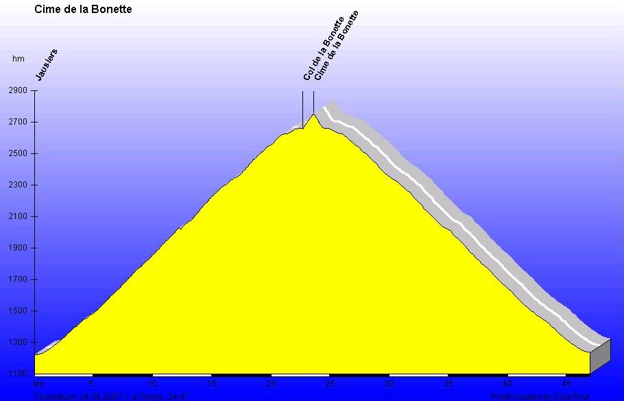
Elevation profile including return way
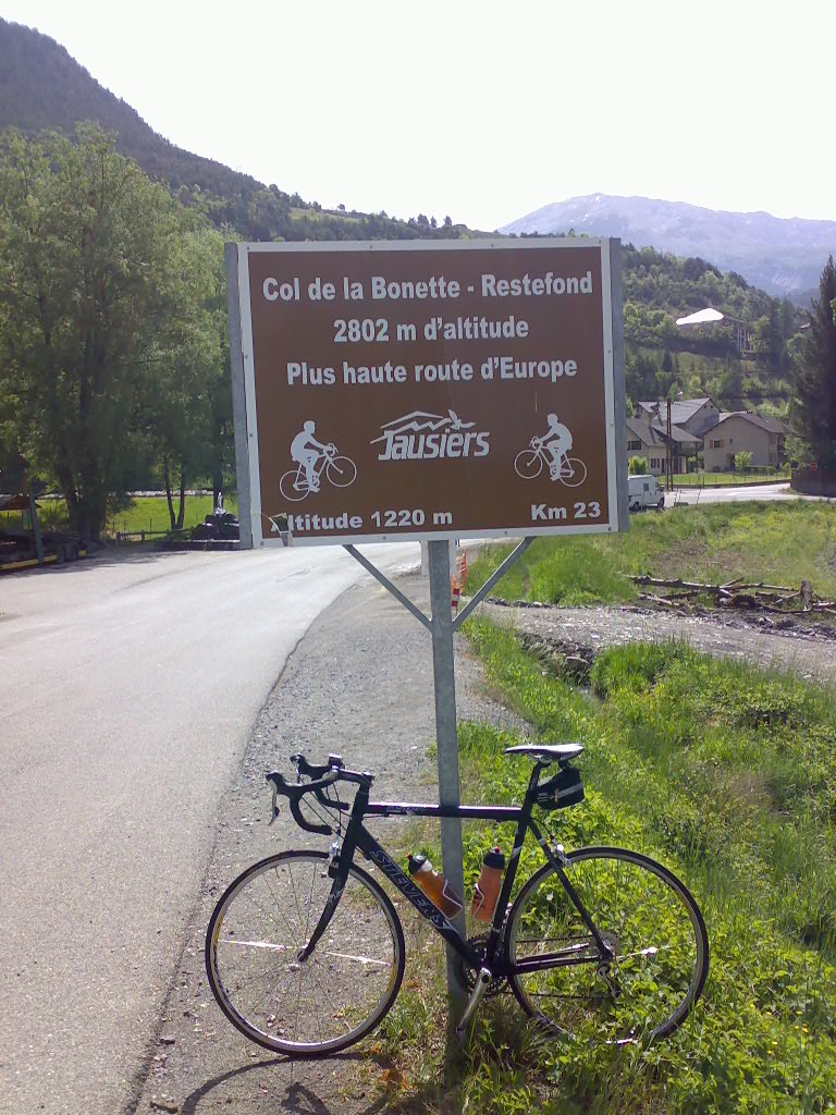
"Plus haute route d'Europe" - However, Pico del Veleta in the Spanish Sierra Nevada and also Ötztal Glacier Road are higher at their peaks!
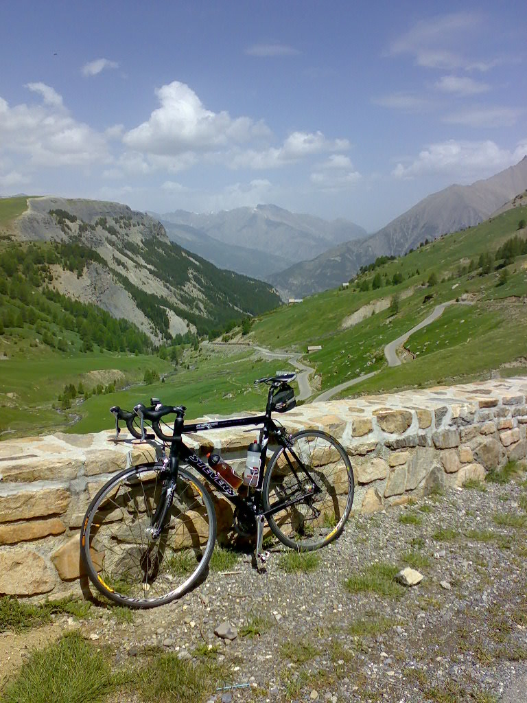
Pleasant landscape, moderate grade
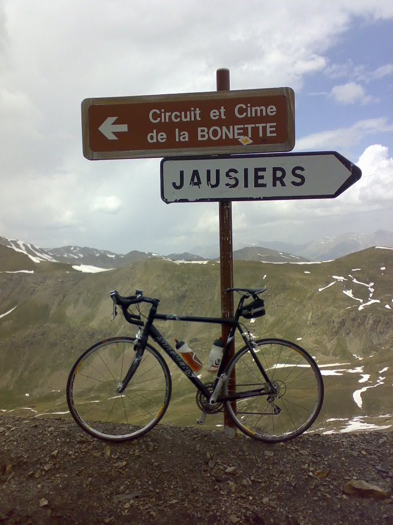
On pass summit the reference to the loop around Cime de la Bonette
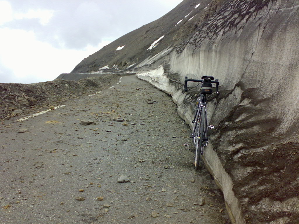
End of May the road has not yet being cleaned up...


 #passzwang