EN
DE


Welcome to the cutting-edge of uphill cycling
and world's most famous ascents of each of the continents
 #passzwang
Welcome to the cutting-edge of uphill cycling
and world's most famous ascents of each of the continents
| Home | |||
| Database | |||
 | World Map | ||
| World's highest cyclable roads | |||
| Overview | |||
| New in 2023 | |||
 | Štulac Sedlo | 1,957m | |
| | Durmitor Sedlo | 1,908m | |
 | Sveti Jure | 1,762m | |
 | Qafa Thores | 1,681m | |
 | Visočica Sedlo | 1,625m | |
 | Galičica Sattel | 1,564m | |
 | Prevalac | 1,560m | |
 | Modré Sedlo | 1,500m | |
| | Vrbatova Bouda | 1,400m | |
| | Qafa Bordolecit | 1,355m | |
| | Krstac | 958m | |
 | Suur Munamägi | 318m | |
 | Gaizinkalns | 312m | |
 | Aukštojas | 294m | |
 | Cap de Formentor | 225m | |
| New in 2022 | |||
 | Zillertal Höhenstr. | 2,015m | |
 | Mt. Olympos | 1,950m | |
 | Juvasshytta | 1,851m | |
 | Monte Zoncolan | 1,750m | |
 | Sliezsky Dom | 1,670m | |
| | Dalsnibba | 1,459m | |
 | Spindlerpass | 1,200m | |
 | Kekestetö | 1,014m | |
 | Flatruet | 975m | |
| | Trollstigen | 866m | |
| | Ørnevegen | 623m | |
| European Alps | |||
| | Theodulpass | 3,332m | |
 | Hohtälli | 3,286m | |
 | Col du Jandri | 3,150m | |
| | Hohsaas | 3,142m | |
| | Madritschjoch | 3,123m | |
| | Rothorn | 3,103m | |
| | Gornergrat | 3,089m | |
| | Gaislachkogel | 3,040m | |
| | Ortlerhaus | 3,025m | |
| | Wurmkogel | 3,023m | |
| | Colle Sommeiller | 3,009m | |
| | Festkogel | 2,898m | |
| | Eisjöchl | 2,895m | |
| | Stubai Glacier | 2,889m | |
| | Ötztal Glacier | 2,822m | |
| | Cime de la Bonette | 2,802m | |
| | Col de l'Iseran | 2,770m | |
| | Viderjoch | 2,763m | |
| | Stilfser Joch | 2,758m | |
| | Kaunertal Glacier | 2,750m | |
| | Colle dell'Agnello | 2,744m | |
| | Col du Chaberton | 2,674m | |
| | Gaviapass | 2,652m | |
| | Col du Galibier | 2,645m | |
| | Colle del Nivolet | 2,612m | |
| | Großglockner | 2,571m | |
| | Timmelsjoch | 2,509m | |
| | Umbrailpass | 2,503m | |
| | Nufenenpass | 2,478m | |
| | Great St. Bernard | 2,473m | |
| | Furkapass | 2,436m | |
| | Hochwurtenspeicher | 2,422m | |
| | Großsee | 2,414m | |
| | Oscheniksee | 2,394m | |
| | Col d'Izoard | 2,360m | |
| | Albulapass | 2,315m | |
| | Uina Gorge | 2,309m | |
| | Julierpass | 2,284m | |
| | Kronplatz | 2,275m | |
| | Sellajoch | 2,240m | |
| | Passo Pordoi | 2,239m | |
| | Passo Giau | 2,236m | |
| | Sustenpass | 2,224m | |
| | Little St. Bernard | 2,188m | |
| | Grimselpass | 2,164m | |
| Rocky Mountains | |||
 | Mount Evans | 4,307m | |
| Hawaii | |||
| | Mauna Kea | 4,200m | |
| Germany | |||
 | Osterfelderkopf | 2,032m | |
| | Nebelhorn | 1,932m | |
| | Alpe Schlappold | 1,740m | |
| | Eagle's Nest | 1,716m | |
| | Roßfeld-Höhenring | 1,540m | |
| | Riedbergpass | 1,420m | |
| | Feldberg | 1,493m | |
| | Fichtelberg | 1,215m | |
| | Brocken | 1,142m | |
| | Salwert | 11m | |
| Other Europe | |||
| | Sniezka | 1,602m | |
 | Klinovec | 1,244m | |
 | Botrange | 694m | |
 | Kneiff | 560m | |
 | Vaalserberg | 323m | |
 | Møllehøj | 171m | |
| Andes | |||
 | Uturuncu | 5,768m | |
| | Chacaltaya | 5,300m | |
| | Salar de Uyuni | 3,650m | |
| | Yungas Death Road | 3,200m | |
| Himalayas | |||
 | Khardung La | 5,602m | |
| | Taglang La | 5,358m | |
| | Potokonkga La | 4,900m | |
| | Namshang La | 4,800m | |
| | Lamayuru Monastery | 3,714m | |
| Ethiopian Highlands | |||
 | Tulluu Dimtuu | 4,377m | |
| Alborz-Range (Iran) | |||
 | Dizinpass | 3,257m | |
| | Emamzadeh Davod | 2,929m | |
| Marathon (European Alps) | |||
| | Ötztal Cycle Marathon | 5,209Hm | |
| | La Marmotte | 5,180Hm | |
| | Maratona Dolomites | 4,190Hm | |
| | Dreiländergiro | 3,546Hm | |
| | Alpenbrevet | 3,643Hm | |
| | Alpen-Challenge | 2,499Hm | |
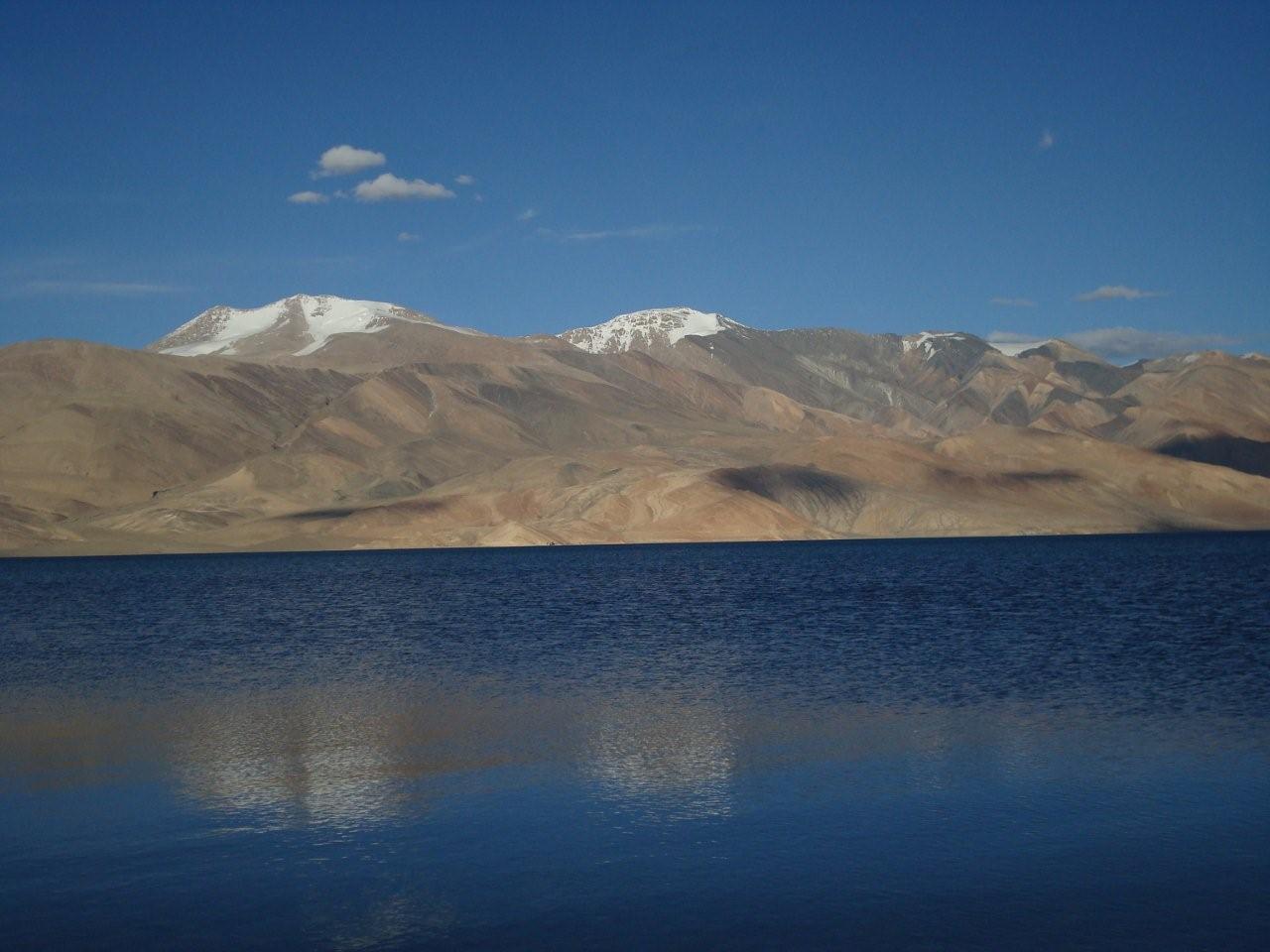
Namshang La is situated in Eastern part of Northern Indian Ladakh and connects Indus-Valley in the North with the high plateau of Tsomoriri, a huge lake at an altitude of 4,500m close to the border to Tibet. Actual altitude of the pass is unknown. Map data alternate from 4,800m to more than 5,000m. On pass summit one can find hundreds of Buddhistic prayer flags but no reference to the actual altitude. A barometric altimeter confirms a height of some 4,800m. Northern ramp starts at river Indus at a police station in the village Mahe at approx. 4,250m of altitude. Specified tour actually started at the spot of Sumda, led afterwards via the pass, subsequently along the salt lake Thatsang Karu to Tsomoriri Lake. Scenically this pass even beats close-by even higheer passes Khardung La and Taglang La.
Start: Sumda 4,450m
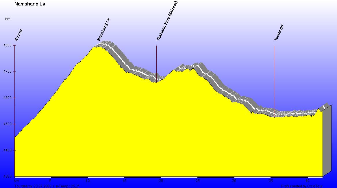
Diversified profile becomes spectacular after the pass summit
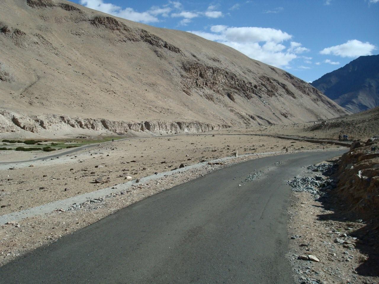
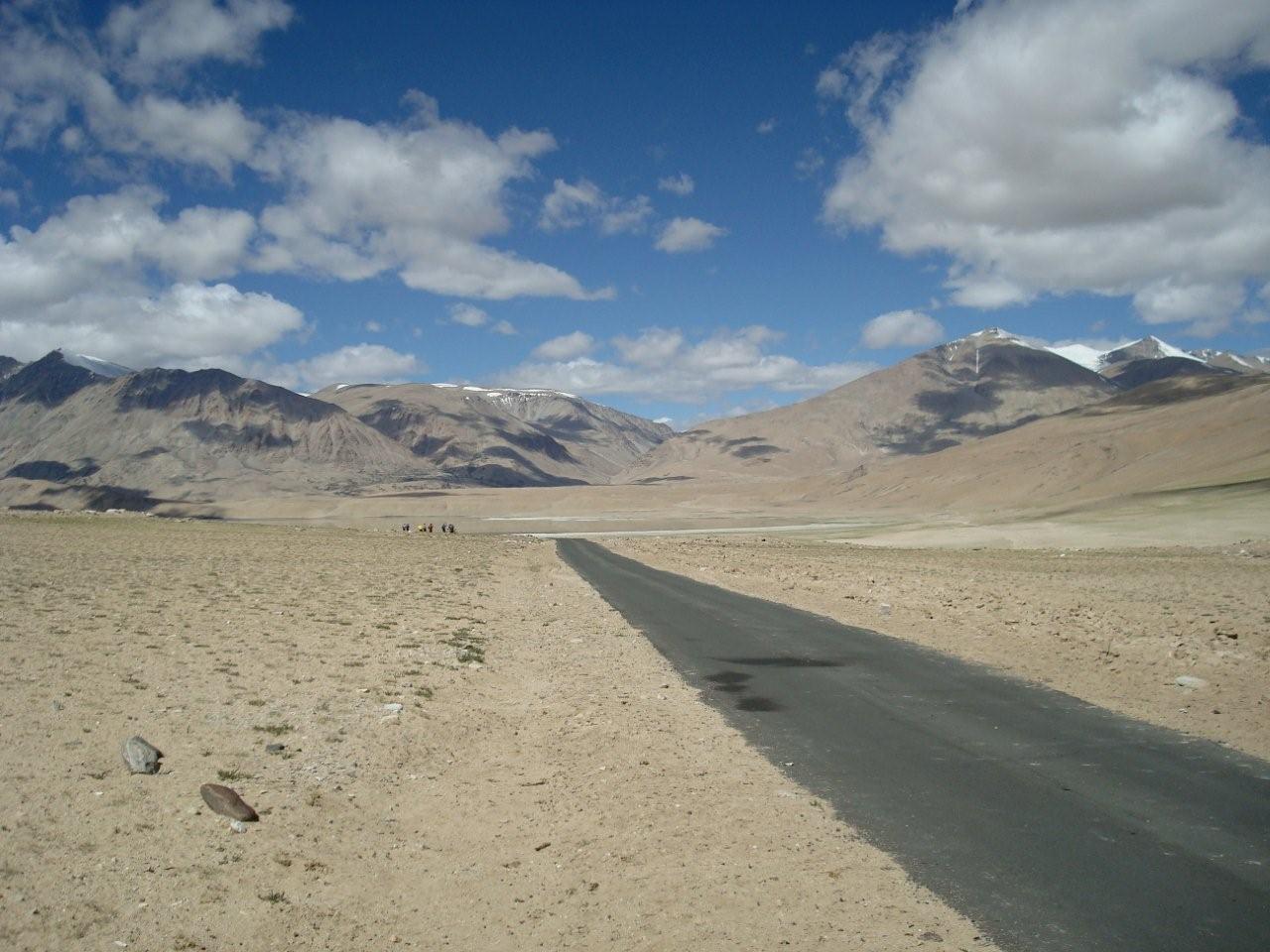
Plainly paved passroad
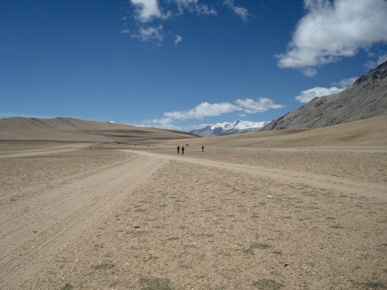
Next to the road only high mountain desert
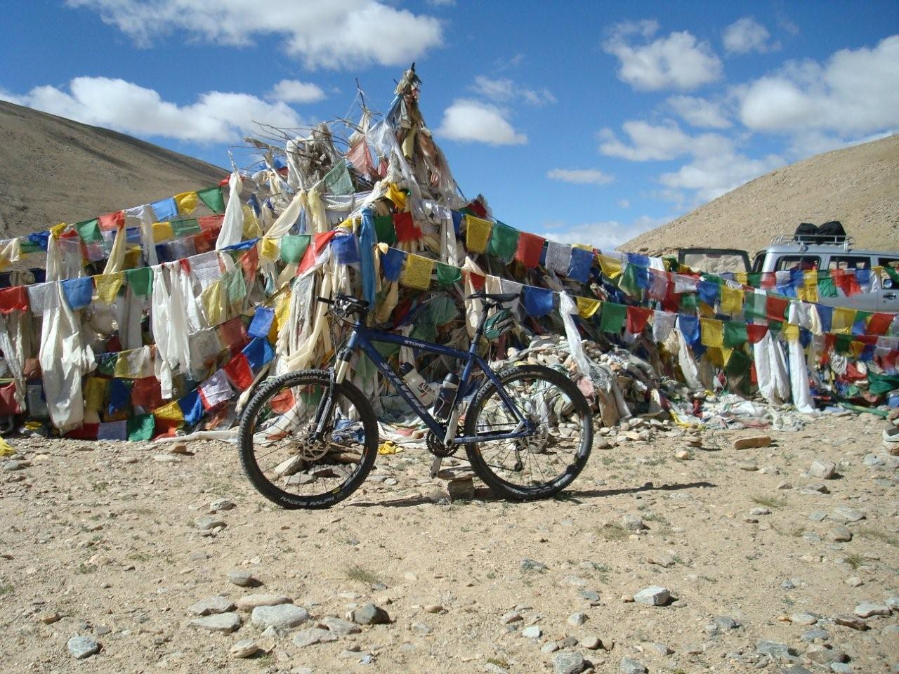
Pass summit
Downhill towards the salt lake
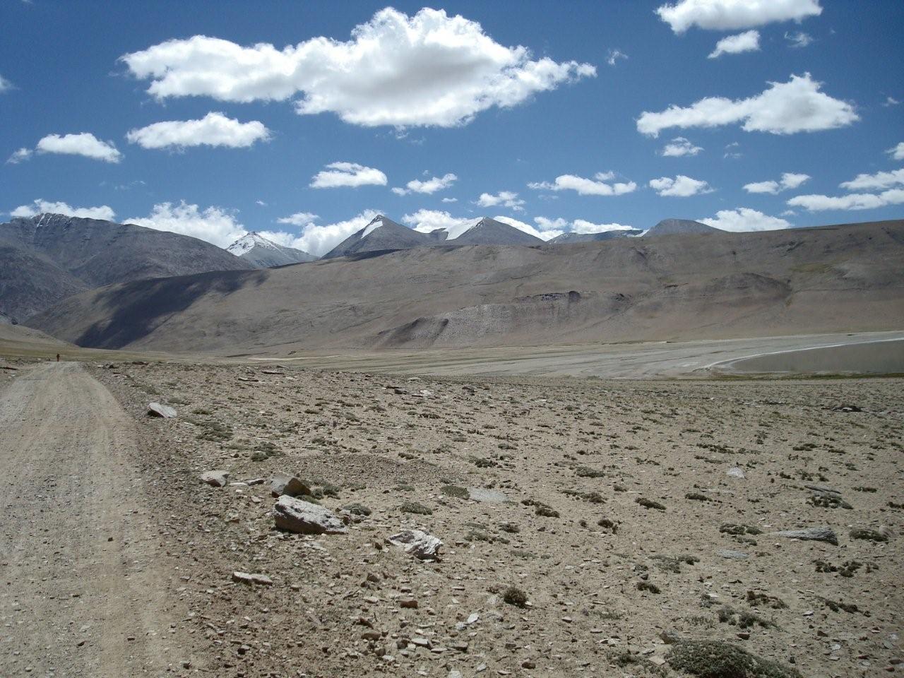
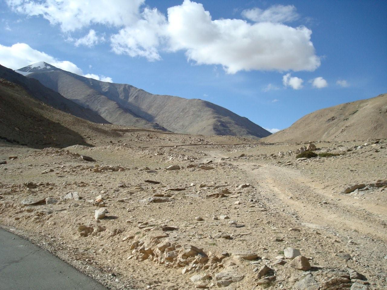
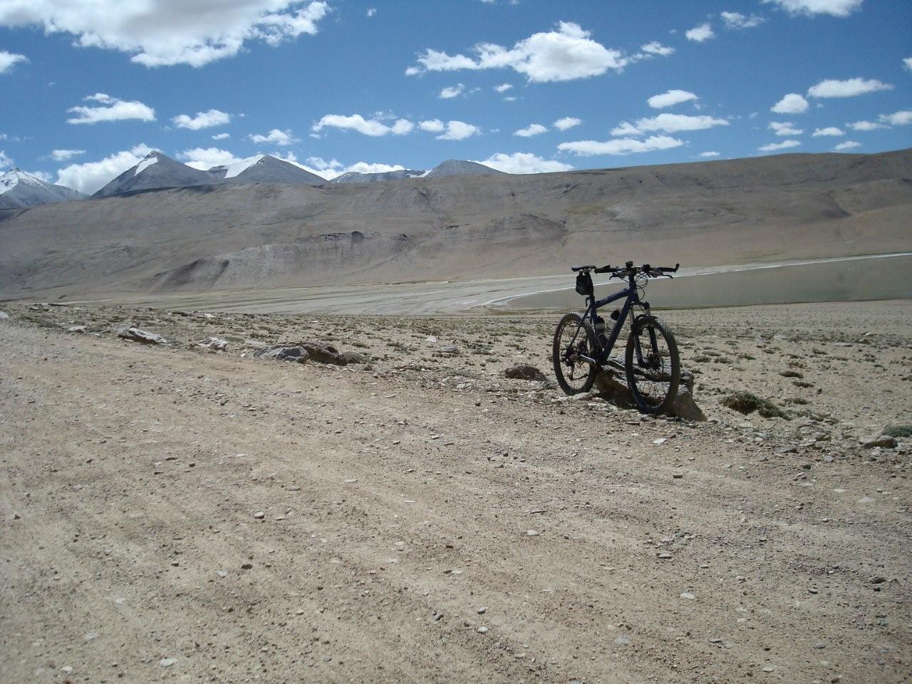
Roadway becomes an unpaved dirt road
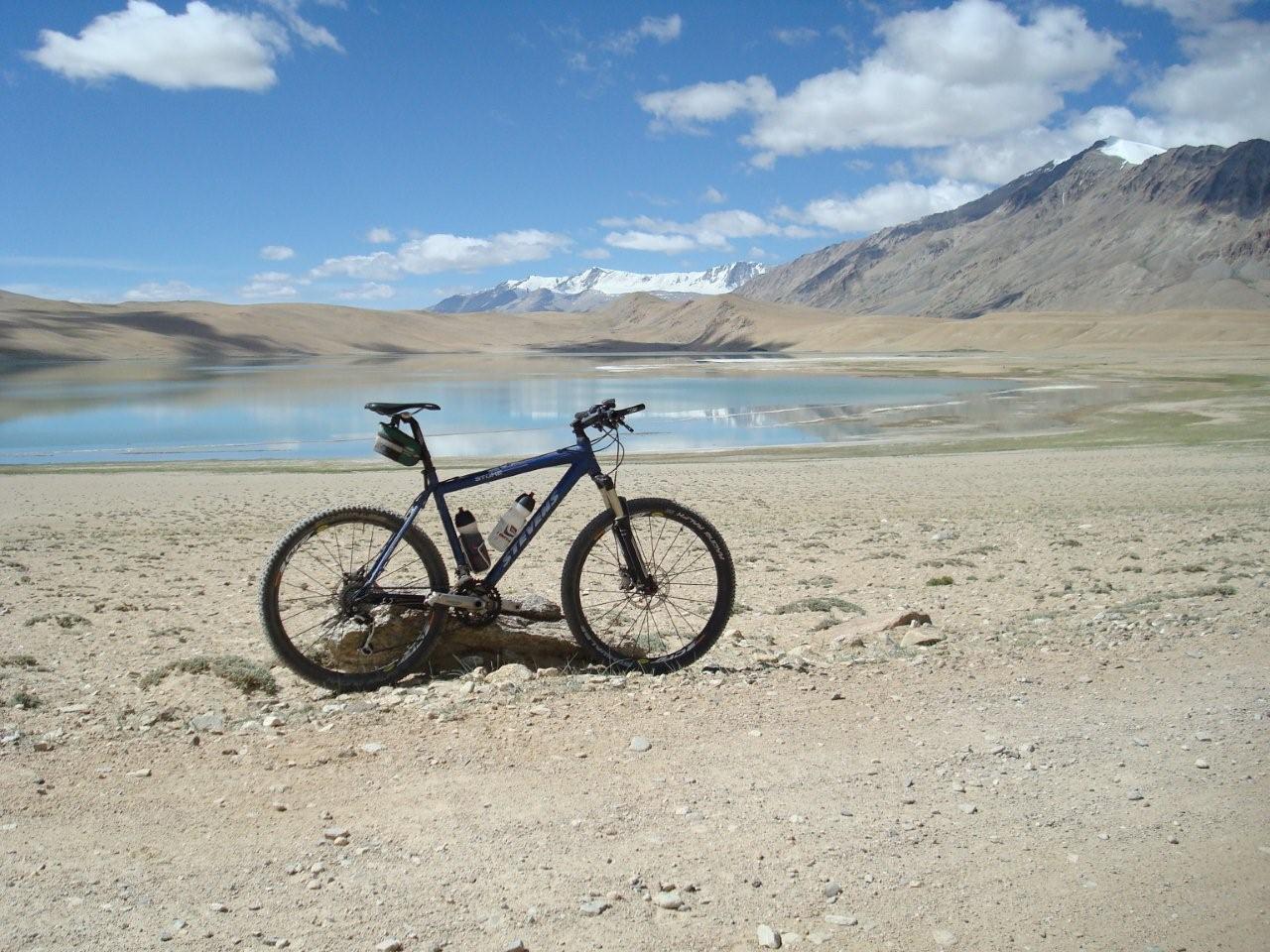
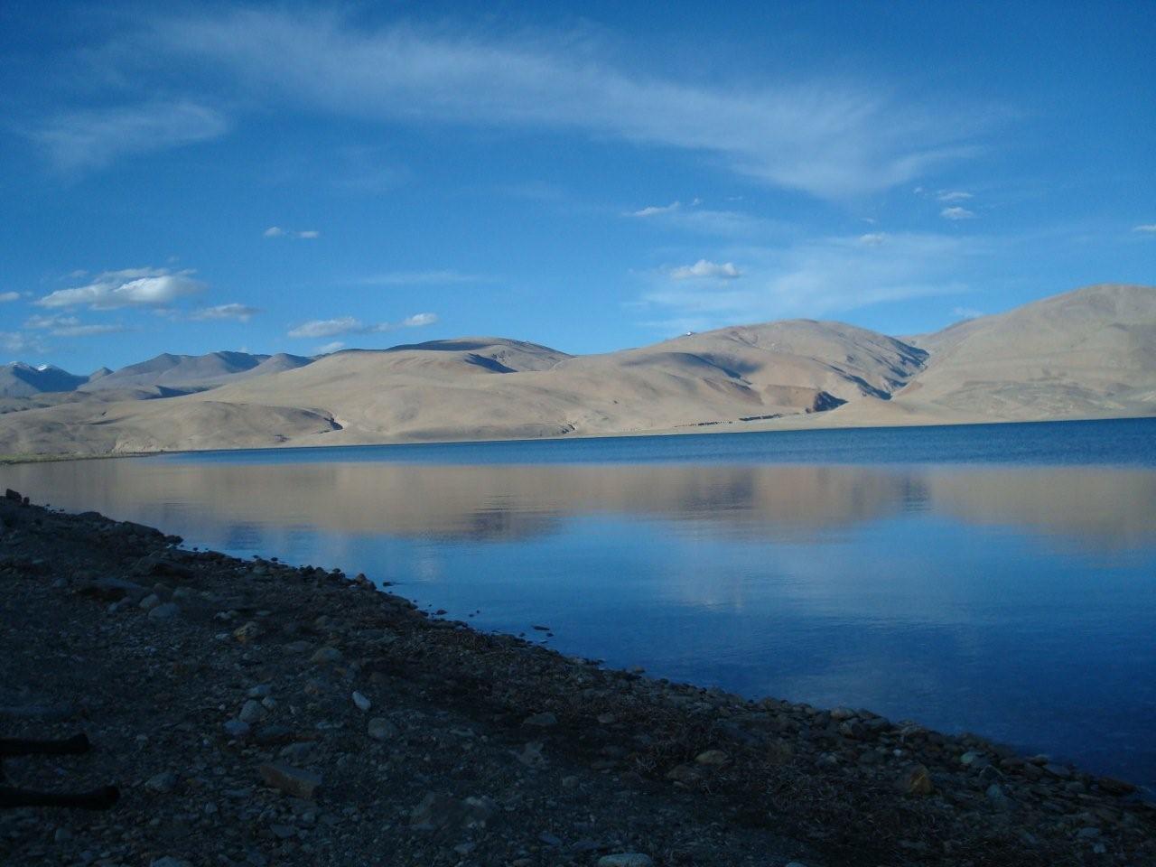
Thatsang Karu, a salt lake...
...is located at a height of some 4,650m
Free traffic at the end of the world close to the border to Tibet
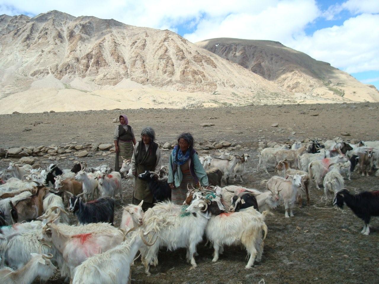
Nomadic people at the roadside with their Paschmina-goats...
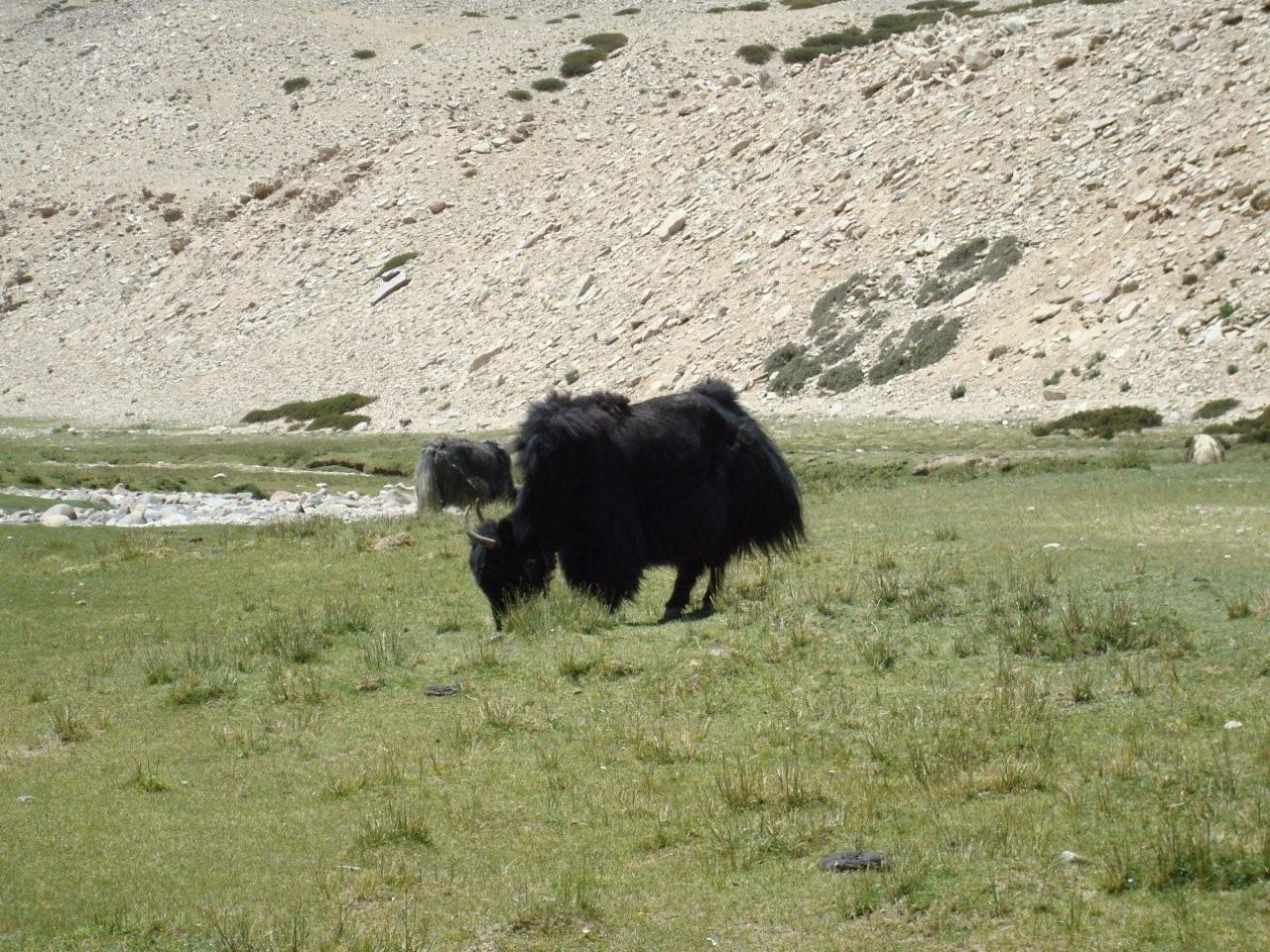
...and scraggy yaks
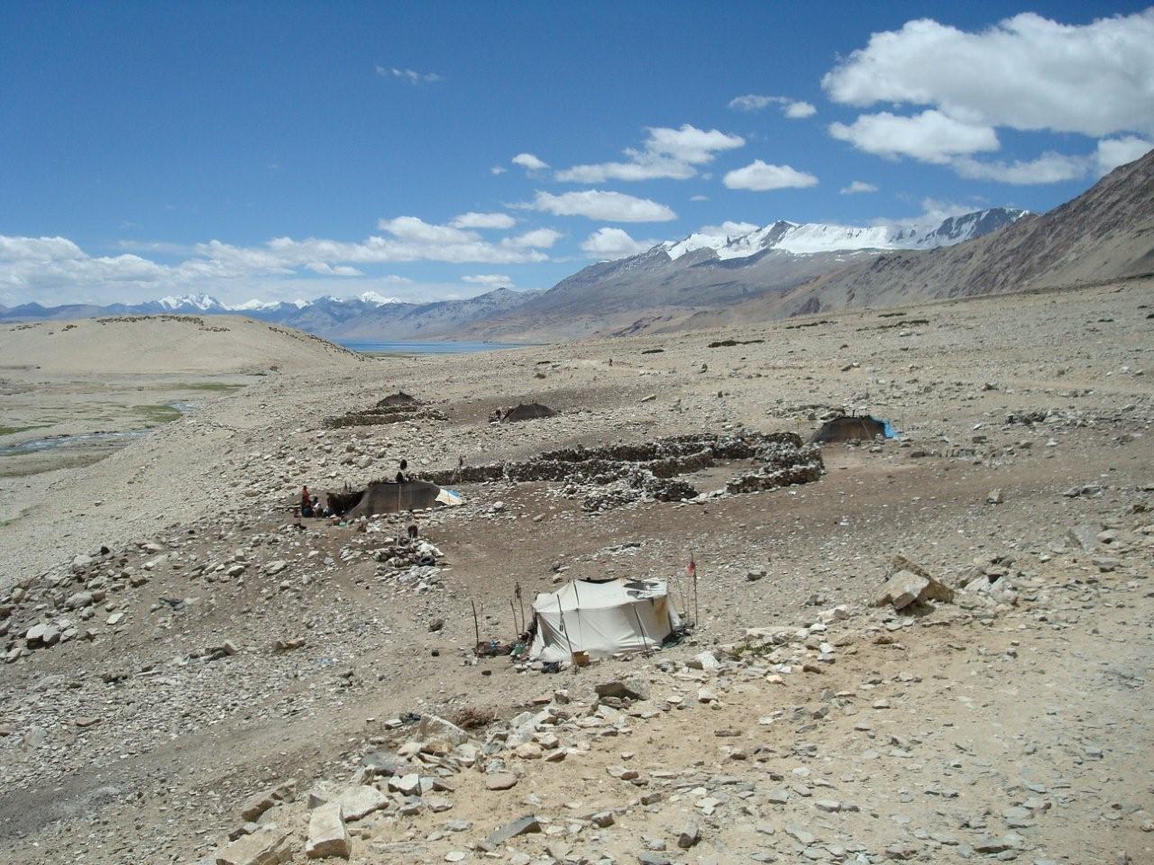
Tents of nomadic people at the roadside on the way to Tsomoriri Lake
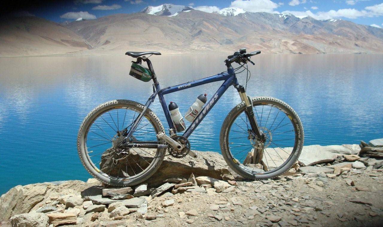
Tsomoriri Lake...
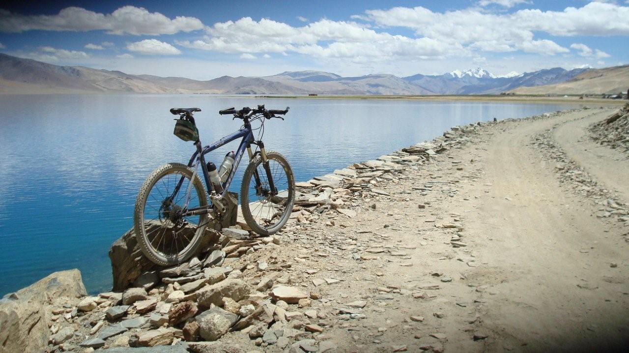
...can only be reached on an unpaved dirt road...
...but provides at sunset...
...a fantastic scenery.


 #passzwang